OMSI District Urban Design Study
Created in partnership with Ian Cunningham
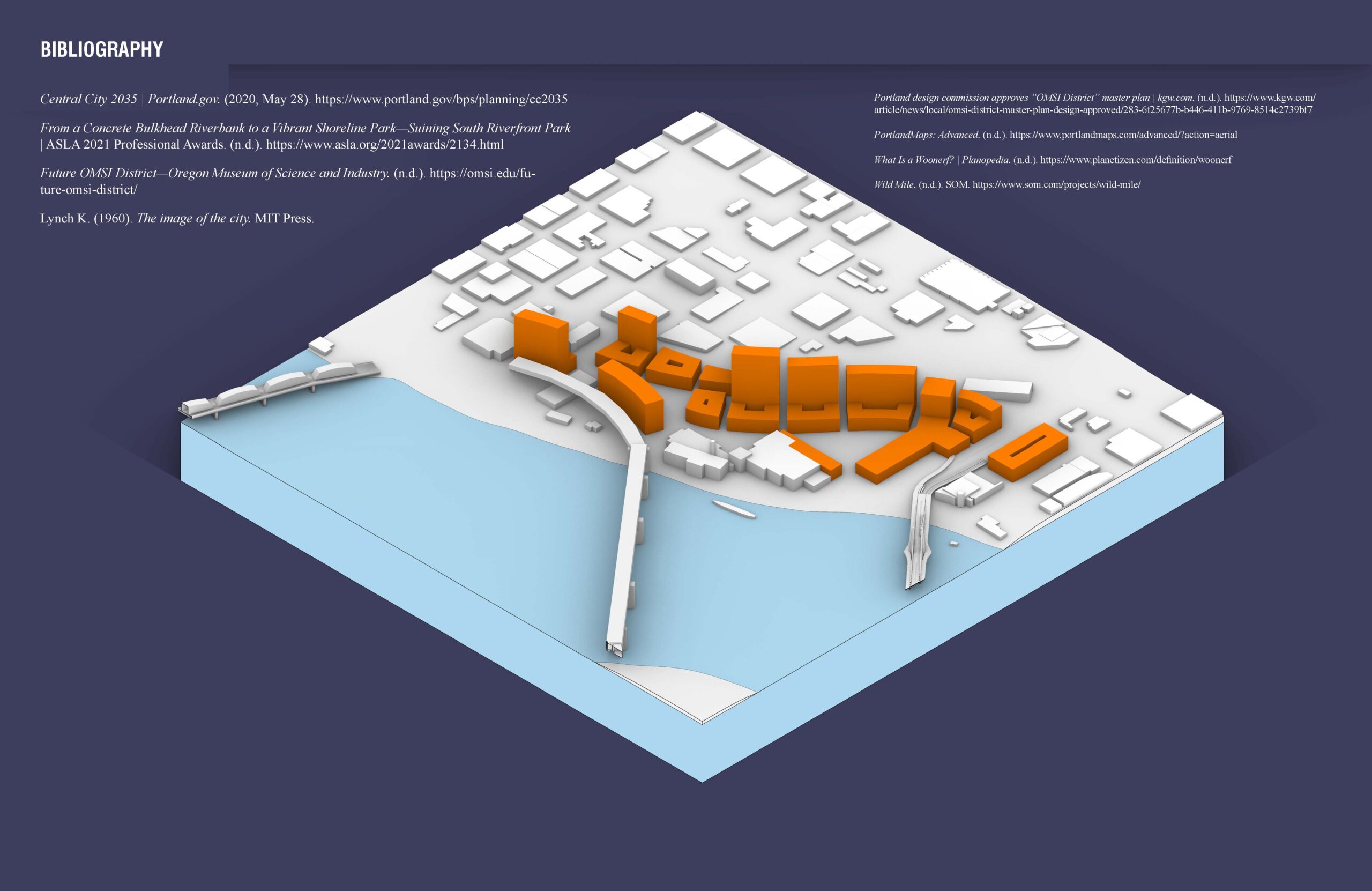
Located along the bank of the Willamette River and with one of the best views and connections to downtown in the city, the Tilikum district is a unique opportunity for the city of Portland. It is an area that has the potential to be developed into a great neighborhood, serving new residents, workers, and visitors alike. For the development to be successful in the future, it is essential that it acknowledges its past. The land that the site occupies has been the territory of several Native American tribes, including the Chinook, Multnomah, and Kathlamet tribes. As Portland grew from a clearing along the Willamette to a prosperous and cultivated city, it has primarily served as a site for industrial uses, including rail facilities, sawmills, power generation and concrete plants, mainly due to its location along the shallower east side river and its initially swampy land being ill-suited for residences or agriculture. The buildings belonging to the Portland Electric Power Company (PEPCO) still exist, as does the old Portland General Electric Power Station L, which is now occupied by OMSI. It is vital that future developments in the district preserve those existing structures as well as respect and sensitively respond to the area’s indigenous and industrial heritage.
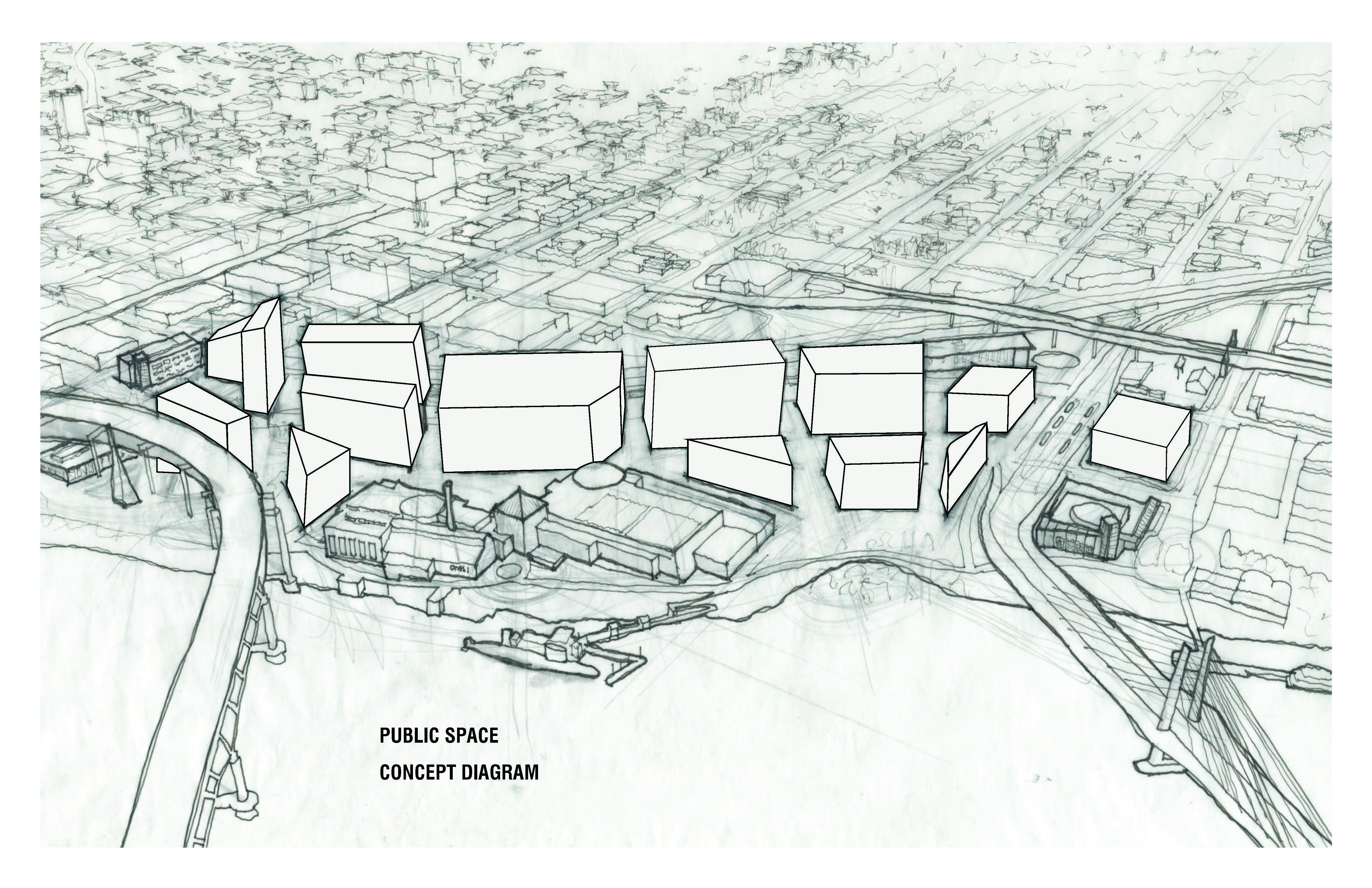
In addition to OMSI, neighboring institutions such as Portland Opera, Station L Rowing Club, PCC CLIMB Center, and the Oregon Rail Heritage Center have been drawing the public to the area for decades, and all that is needed to transform the site into a vibrant district where people want to stay, is a walkable urban fabric to connect them together.
As much as the old industrial characteristics of the neighborhood provide valuable opportunities for economic prosperity and historic preservation, they also create issues that must be addressed through the urban design of the district. The still actively used, at grade Union Pacific Railway isolates the district from the neighborhoods to the east, and the noise from it and the Marquam bridge are constant. Air pollution from the highway and trains is another concern. Furthermore, the existing road network is designed around cars and the surrounding industrial uses rather than people, with no existing dense, walkable street grid or hierarchy of public spaces.
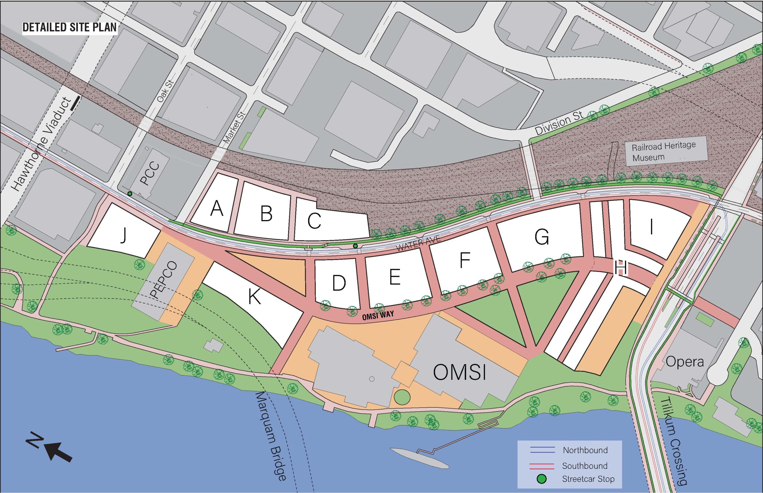
Our vision of the district is to preserve the industrial character of the area, while looking forward to green technologies and reforging the city’s connection to the river. This includes restoring natural habitats that were destroyed during the industrial age. A key element of this vision is to create a complete neighborhood with strong transit and active transportation connections to the rest of the city, particularly the residential areas to the south and east, while creating workforce housing close to jobs in industries within the Central Eastside industrial sanctuary and in the healthcare and biotech industry centered at OHSU across the Tilikum Bridge to the west. We will prioritize active transportation modes such as walking and biking for travel within the district, and divert the Portland Streetcar along Water Avenue for connections to Downtown, the South Waterfront, and East Portland.
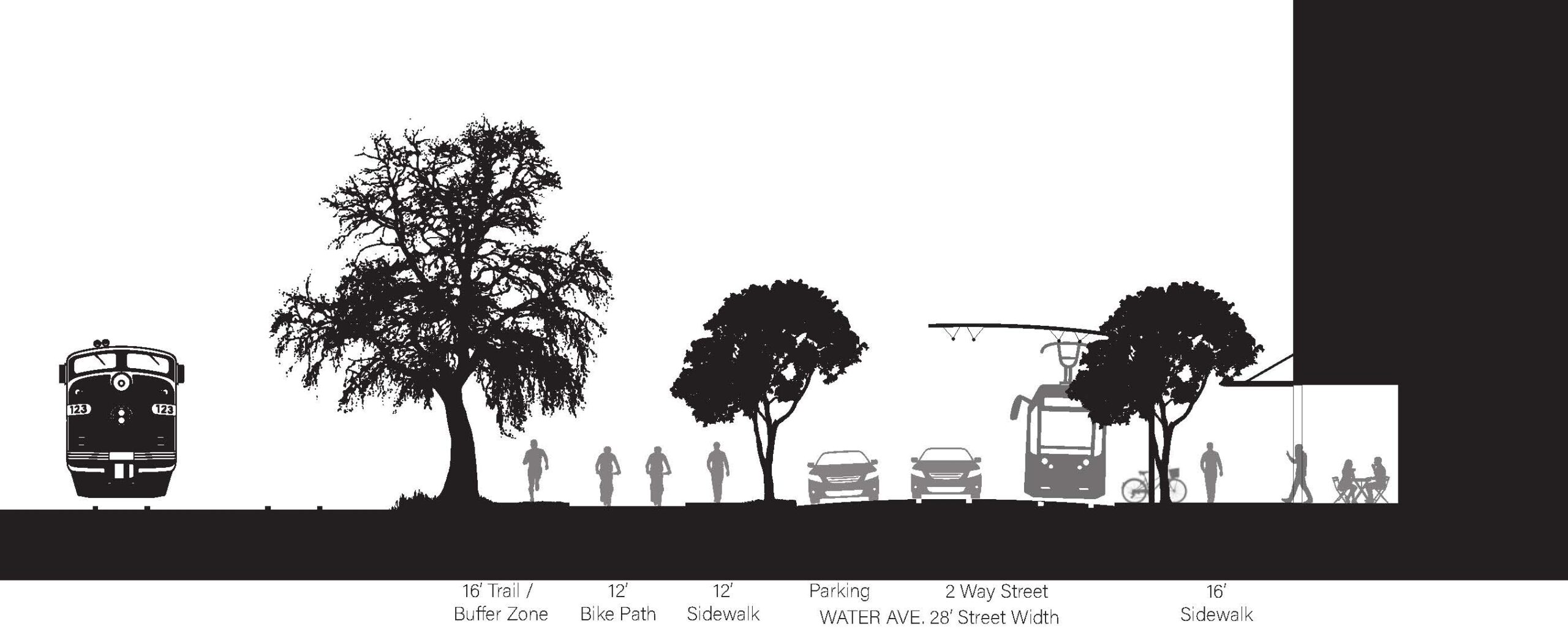
To reduce noise pollution, we will designate compatible uses by zoning the parcels of land directly adjacent to the I-5 bridge for offices or light industrial, which will be less impacted by the noise, and by having taller buildings along the bridge and railway to act as a buffer between the sources of the noise and the residential portions of the site. To the east, we propose a row of trees and greenery along the broader proposed Water Avenue, between the residential buildings and the railway. This noise and air pollution mitigation strategy is one element of a proposal to transform Water Avenue into a vital artery of the district with a boulevard character alongside designating ground-floor commercial uses and retail shops, a two-way protected bikeway, streetcar access, and alternating street trees and parking. At the southern end, the rail heritage center and renovated rail cars will serve as an important anchor, preserving and highlighting the area’s strong historic ties to rail juxtaposed with the continuation of that tradition in the adjacent MAX and Portland Streetcar station, while a repurposed PEPCO building utilizing green technologies such as renewable power generation will do the same at the northern end of the district.
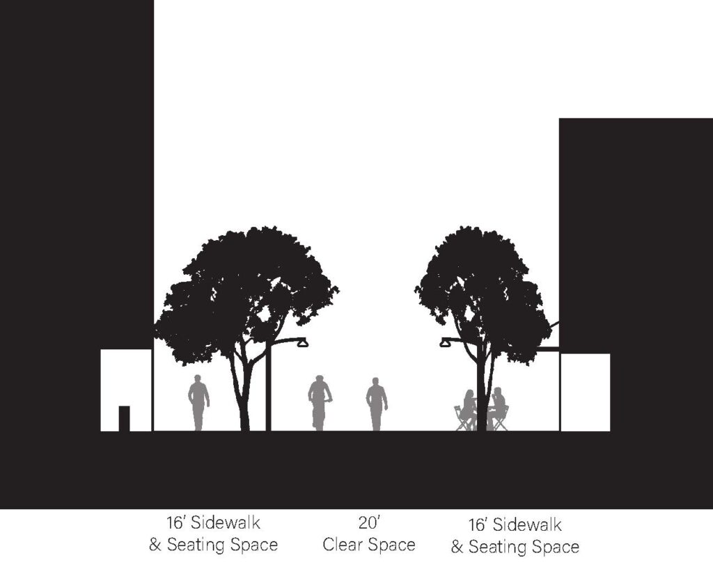
The public spaces are aligned along the central pedestrian spine of the district, OMSI Way, which was designed based on the Woonerf street concept – a shared street designed to prioritize people over cars. It terminates at OMSI Station at the landing of Tilikum Crossing.
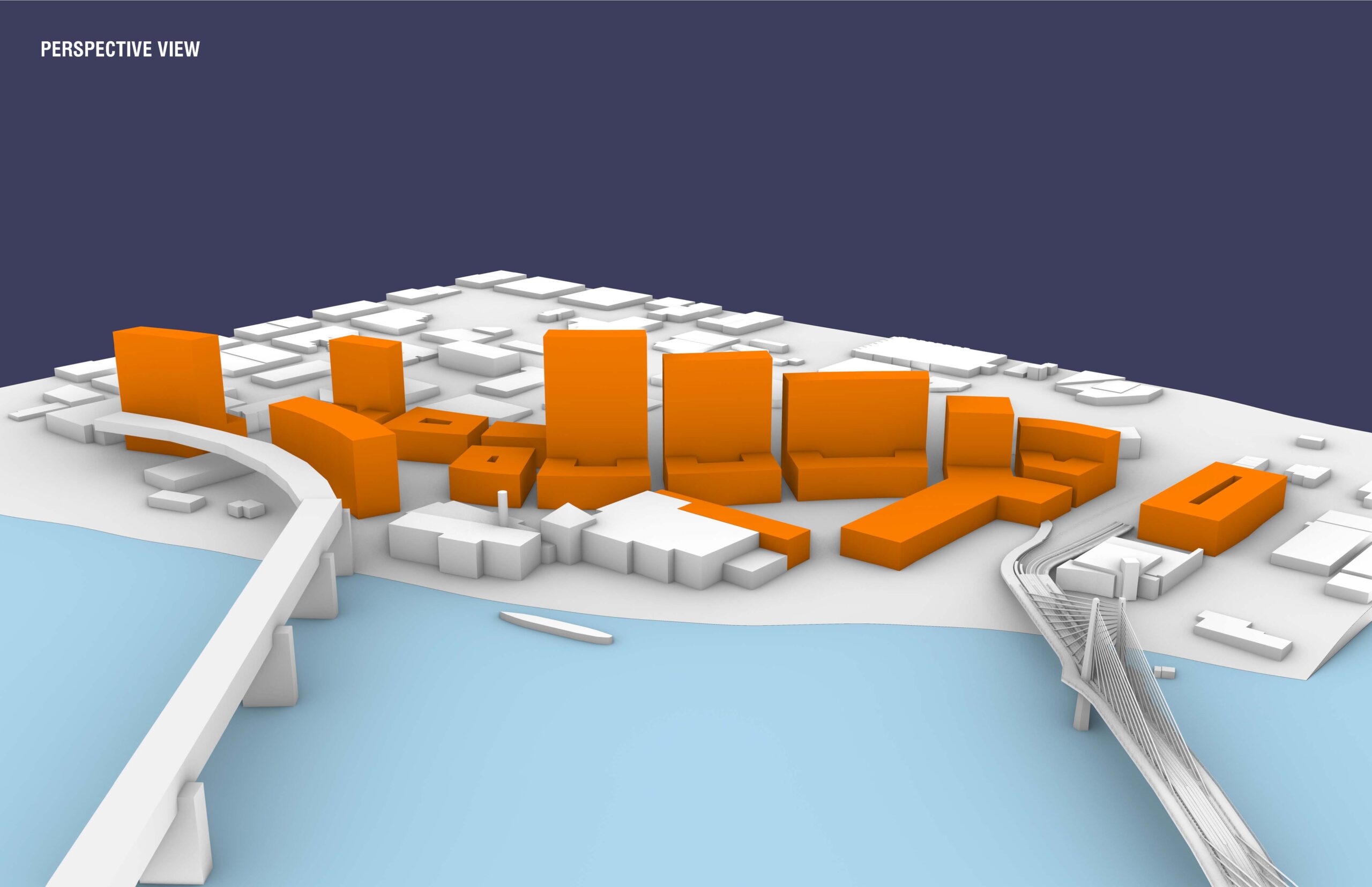
The quality of the new public spaces in the district are critical to its future success. The proposed residential blocks are oriented towards the river and are to the northeast of the majority of the public spaces and the river, enabling them to have direct sunlight on all sides throughout the year, as well as creating the potential for Solar PV arrays. Tall buildings provide opportunities for public rooftops spaces to take advantage of the spectacular views of downtown Portland to the west and Mt. Hood to the east. Transitioning into a covered pedestrian street for a ways, the street passes through a new public market in the vein of other successful public markets, such as Granville Island, Pike Place Market, and Chelsea Market, which serves the central city, punctuates the terminus of the street and acts as a gateway to the district.
